Trinidad to Florida
In November 2005 we left Trinidad to return north through the Windward and Leeward Islands to Sint Maarten. From there we headed back to Florida, experiencing our longest single leg ever, five days at sea from Cuelebra to South Caicos. The story of the entire cruise, the people we met, and the experiences, including being chased at sea by Hurricane Emily, is related in our book Squalls and Rainbows. For the beginning of the cruise see Florida to Trinidad.
Returning Home from Trinidad
We left Trinidad in early November 2005. The worst hurricane season -- maybe ever -- had passed to the north that summer. They ran out of names and had to assign Greek letters. As we left Trinidad an unexpected tropical depression (#27) formed and we ran into its southernmost bands at Grenada.
We stayed two and a half months at Grenada, holed up in the calm, protected Mt. Hartman Bay. During this time, we hauled out for a bottom job in Prickly Bay and flew back to the states for the Christmas and New Year holidays.
Early February we resumed our trek North. The first leg to Carriacou was a difficult slog into strong headwinds and heavy seas. After licking our wounds and tightening everything back up, we made a scenic, if blustery, run through the Grenadines and the famous Tobago Cays to Bequia.
We then returned to Rodney Bay, St. Lucia, and after that anchored off St. Pierre, Martinique, on our way to Prince Rupert Bay, Dominica. There we rode out days of heavy rains, which filled the bay with mud, trees, and other debris.
It was then on to Les Saintes, and Deshaires, Guadaloupe, prior to a long dawn to dusk run past the volcano at Montserrrat to Nevis.
From Nevis we had a lively sail, close on the wind all day clocking record speeds to Sint Maarten. We holed up in the Lagoon for two weeks enjoying the food and shopping of this cruising mecca, and then sailed overnight to Cuelebra.
From Cuelebra we embarked on a direct run to South Caicos, 5 days at sea. The story resumes below.
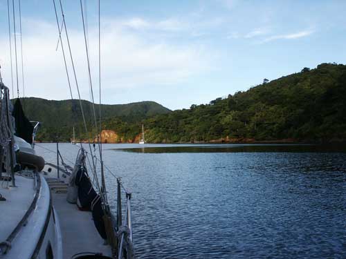
Nutmeg Breeze
[Grenada]
| Sitting on deck at the bow |
| After dinner, rum, blues, and love |
| Quiet, calm, and black |
| Unfamiliar stars overhead |
| Orion lying on his side coming over the western hill |
| Mangroves and hills surround us |
| Joy swells up inside me |
|
| A sudden recognition of how wonderful life is |
| Here, now, in this place, at this time. |
| My thoughts scatter through all the fine times |
| On the water, at the beaches |
| It is as if the travels of the last year |
| Were the purpose of it all |
|
| A light, cool breeze on bare skin |
| I try to feel chill, but cannot |
| My skin is only refreshed |
| The exuberance of my soul seeping out my pores |
| And my breath |
| From a flaming fire inside |
|
| Me and the black night |
| And the cool breeze and quiet stars |
| Have I ever felt better? |
| I can't remember a time |
| But I will remember this inexpressible happiness |
| This night |
| In a deserted cove |
| On the southern coast |
| Of Grenada |
[Revolution, Chocolate, and Rum]
St. George's is the capital of Grenada. It was built in an old volcanic depression on the southwest coast. A natural harbor protects it from the sea, and it is surrounded by hills. The streets are narrow and hilly, with red roofed buildings of the close cropped French look. Up one of the hills overlooking the town and harbor are two forts and a prison. One of the two forts was bombed by U.S. forces during the 1983 invasion.
There is considerable good will towards the United States for freeing Grenada from a Cuban led dictatorship. Near the forts is a prison, where the coup leaders responsible for killing Maurice Bishop and others were held until Hurricane Ivan freed them. Some were still at large during our visit.
We toured the Grenada Cooperative Nutmeg Association plant, the Grenada Chocolate Factory, and the River Antoine Rum distillery.
On the northern coast the fishing village of Sauteurs sits atop a hill overlooking the ocean. After the French arrived to settle Grenada, they decided to wipe out the local Carib Indians. The Caribs fought their last stand at Sauteurs. Most were killed and the remainder, deciding not to surrender, gathered and formed a line. The line led to the cliff, and one by one they leapt to certain death. The cliff is called, appropriately, "Caribs Leap."
In the middle of Grenada is the Grand Etang reserve, a mountainous region and the beautiful Grand Etang lake. Once a thick rain forest, the mountains are a ghost town of trees. From a distance it looks normally green, but up close you see only the brown skeletons of once lush trees wrapped in opportunistic green vines. It will take centuries to restore the rainforest.
The full description of our tours and living in Grenanda is in Squalls and Rainbows.
[Bequia]
We watched helplessly, and terrified, as a heavy 42' sailboat drifted down on our home crashing into her bow. We flagged a nearby small boat to run us out to Nalani, praying the hull had not been holed. In a few minutes our home and all our possessions could be underwater.
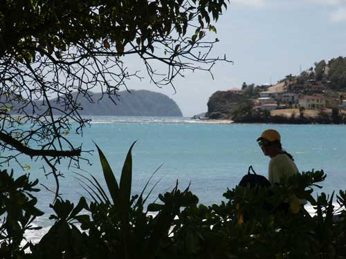
This drama unfolded before our eyes while walking along the shore of the anchorage at Bequia. Fortunately, the damage was minor and easily repaired.
[Stocking up in Sint Marteen]
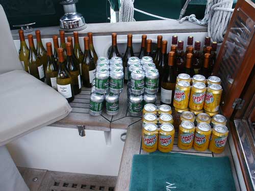
During our layover in the Lagoon at Sint Marteen, we restocked Nalani for the run back to Florida.
Sint Maarten is the Dutch half, and St. Martin the French half, of the popular northern Leeward island. Beaches, bays, and lagoons, fringe a hilly terrain laced by modern roads and speckled by towns hosting the best shopping in the Caribbean.
The most popular anchorage is the Simpson Bay Lagoon on the west side of the island. The Lagoon is completely enclosed by land. The only waterway egresses are a canal to Simpson Bay at the southwest corner and a dredged channel north to Marigot Bay. The northern half lies in French territory and is mostly quiet and remote.
The southern half is Dutch where most boats anchor. Shops, marinas, and numerous services lie along the shores. It is a mile wide and three miles long, and it supports thousands of boats.
On the French side, Marigot Bay is also a popular anchorage and it offers a large marina. However, it is exposed to the north and not always comfortable. Philipsburg Bay at the capital serves the cruise ships. There are a few other mostly daytime anchorages around the island, subject to conditions.
Squalls and Rainbows
[Sint Maarten to South Caicos]
The sail vane tugs the wheel, pulling Nalani off the wind. We are running west on a broad reach. It's blowing twenty knots and the seas are six to ten feet. Nalani lifts on the crests and dips into the troughs, rolling side to side. We are in the open ocean somewhere north of the Dominican Republic and south of the Navidad Banks.
Below is a loud chorus of clanging pots, thumping books, and rattling stores. Water sloshes and slaps against the hull, the rigging twangs and rings, the sails flap, and the hull creaks and groans.
We live this way for five days and four nights. We see no fish, no birds, and no other boats. There is nothing but sky, clouds, and the constantly rolling, frothing, ocean.
We left Sint Maarten a week ago, and are sailing from Cuelbra to South Caicos.
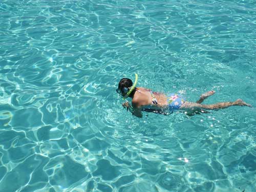
[Snorkeling on the Turks & Caicos Banks]
We left Provo on a calm, sunny day and anchored on the western edge of the banks north of the Sandborne channel.
We followed a natural channel through shallows and reefs into a pool of clear water with a sand bottom. The pool was ten feet deep and maybe a hundred yards wide. The water was crystal clear and calm. There is nothing but open sea in every direction.
We appear suspended in air, the water is so clear. We float alone, a tiny spec on a great sea, tethered by our small anchor. It is exhilarating, but it is also nerve wracking, to be so alone and vulnerable.
We watched the sun set that night feeling our significance dwindle, afloat on a vast sea, under a sky billowing in vibrant reds, yellows, and oranges.
[South Caicos to Florida]
From South Caicos, we sailed to Mayaguana, where we cleared back into the Bahamas. We then spent a week on Samana Cay.
Samana is a small, uninhabited island. It is rarely visited and has a difficult and unmarked channel into Fisherman's Bay, its sole protected waters. The channel weaves a thin, dangerous path through the fringing coral reef.
For the adventuresome few that make their way there, Samana is a gem. The shoreline is a lovely contrast of white cliffs, scrub brush, rock formations, and flat sand. The waters are clear and packed with live reefs of colorful fish. It is untrammeled by human existence, except for a few wooden fishing huts, and the remnants of old stone buildings, at the top of Fisherman's Bay.
From Samana, we sailed to Clarence Town, Long Island, and then to our favorite Conception Island, for a three-day rest before our run home.
We left Conception Island determined to return to Florida without delay. We sailed on good winds to Hawks Nest Point, Cat Island, and then the next day across Exuma Sound to Dotham Cut, where we anchored off Black Point.
We followed the Exuma islands north, with overnight stays at Shroud and Highborne Cays. We then crossed the Yellow Banks to Rose Island, near Nassau.
We continued the next day to the Berry Islands, where we anchored off the east coast of Chubb Cay, tucking up near the flats. A front came through, and then another, bringing lines of squalls. We waited two days as black storms whipped up the seas with loud cracks of thunder, bright streaks of lightning, and downpours. Finally, a brief lull was forecast.
We ran up the Tongue of the Ocean through the Northwest Channel and anchored off Russell Light. The next day we crossed the Banks, and emerged into the Gulf Stream at South Riding Rocks.
We set the autopilot for Florida, adjusting its angle for the cross-current. The sun went low into an arc of gray clouds. Streaks of white-yellow sunlight broke through the gray. The sky became a canvas of oranges and reds onto which dabs of yellows and pools of blue were painted. Behind us, incredibly, a huge rainbow formed. It covered half the sky with distinct wide bands of color, an arc over the Bahamas. It was a symbolic goodbye; a thank you, and an end to our journey.
